


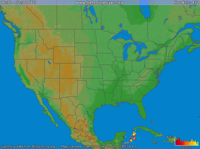
Real Time Lightning - LightningMaps.org
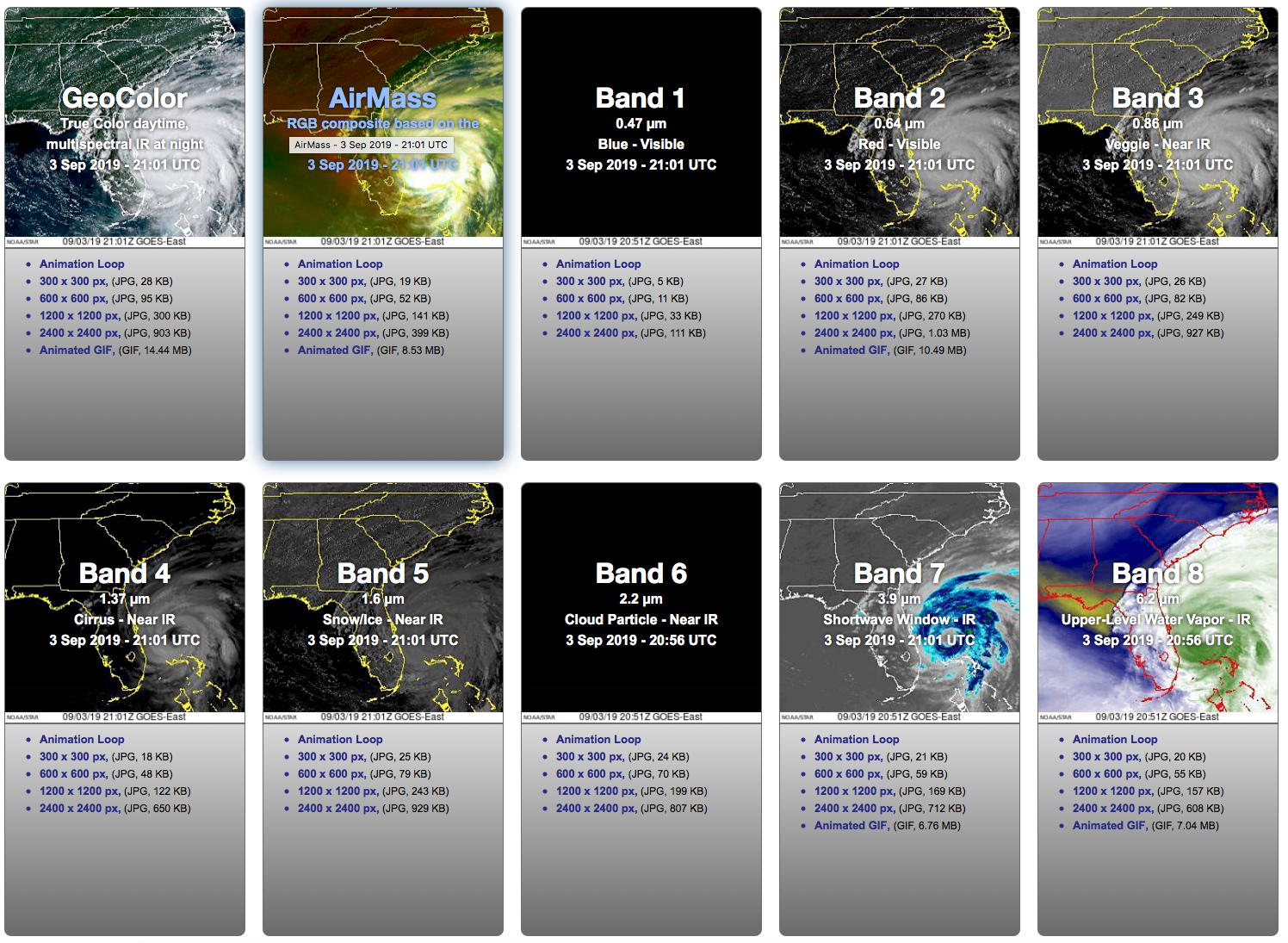
GOES 16 Image Viewer

24 Hour NHC Forecast Map

24 Hour Precipitation Map

48 Hour Precipitation Map

72 Hour Precipitation Map
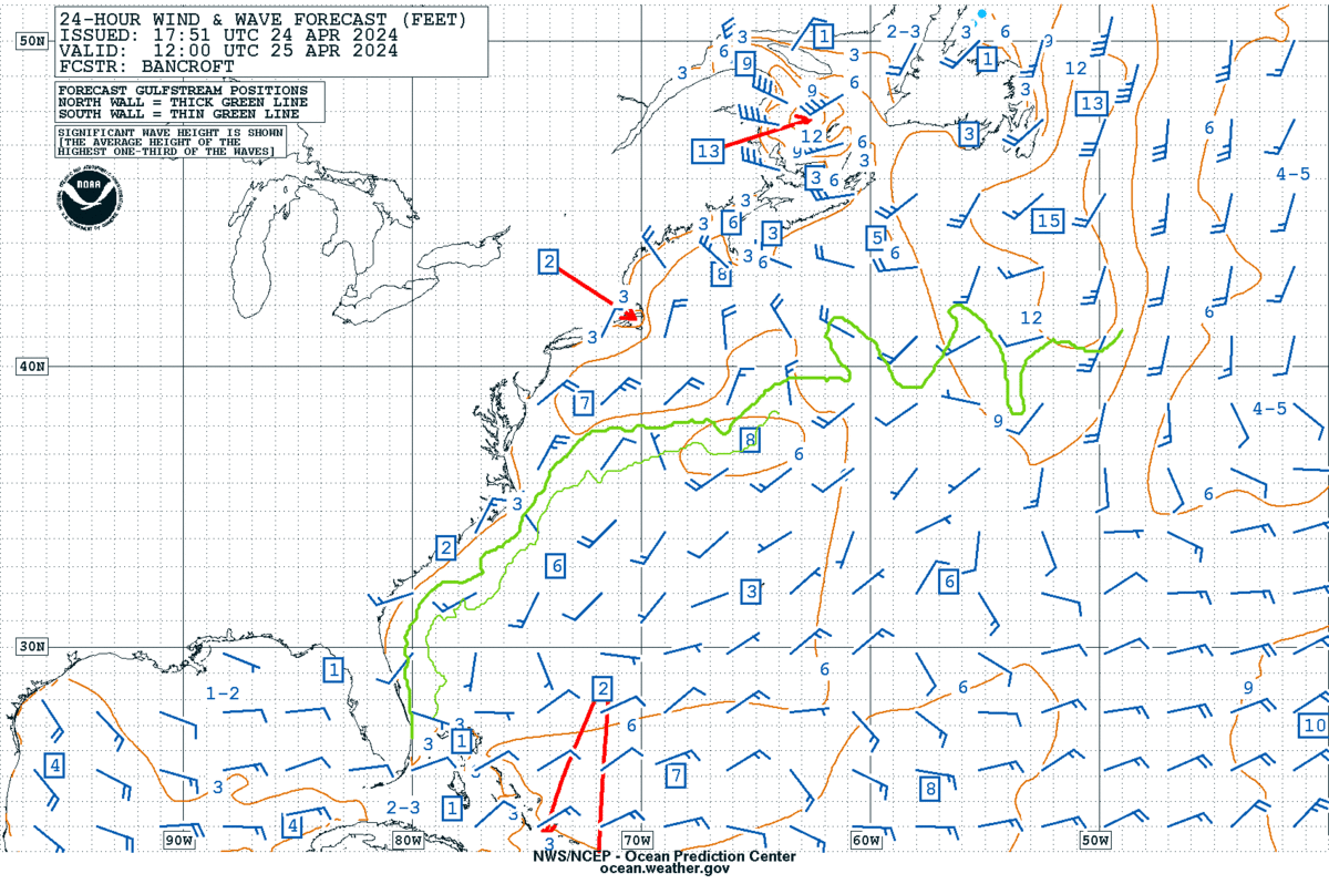
24 Hour Wind and Wave Precipitation Map
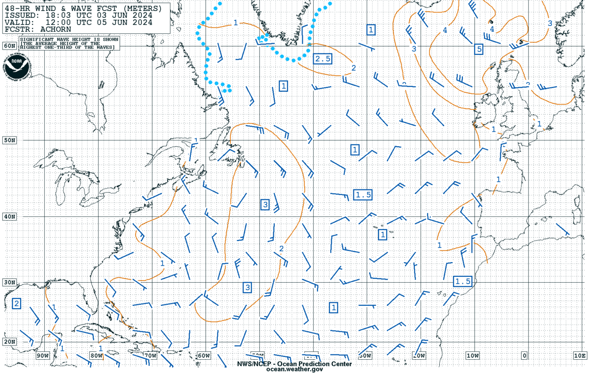
48 Hour Wind and Wave Precipitation Map
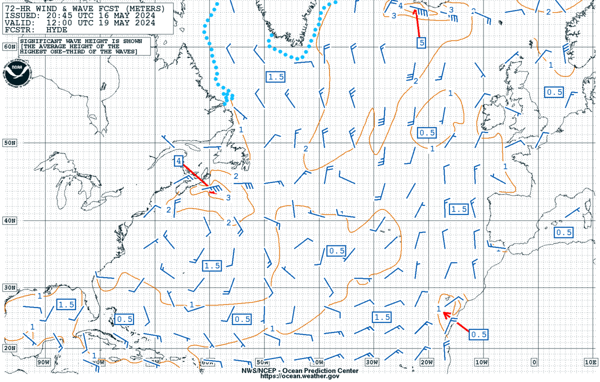
72 Hour Wind and Wave Precipitation Map
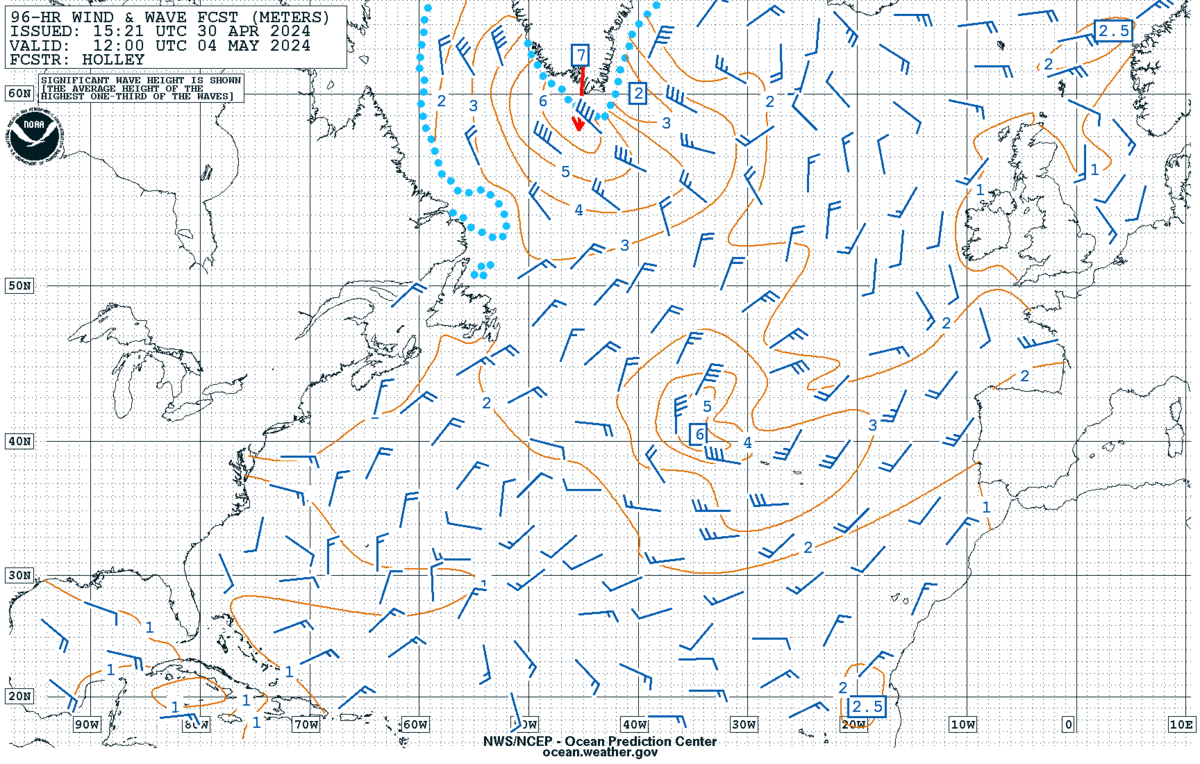
96 Hour Wind and Wave Precipitation Map
East Coast Forecast

Five Day Tropical Outlook

Two Day Tropical Outlook